This article and photos were posted on Mike Robinson-Johnson’s Facebook page on November 20, 2025.
Thank you Mike for sharing the history of this wonderful drive!
‘Work 30 days and Shave 10 from your sentence.’
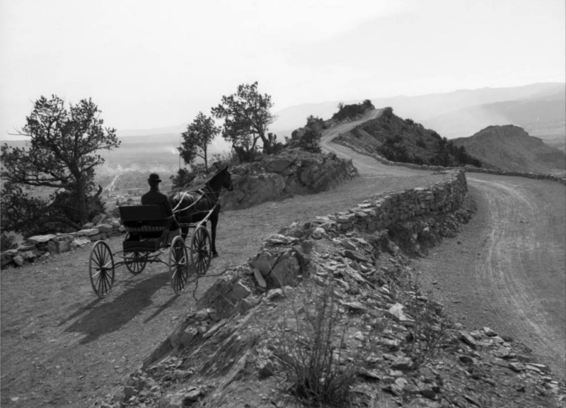
That was the deal given to 60 inmates of Colorado Territorial Prison located in Canon City. The year was 1905 when they were told to help build Skyline Drive.
As the century turned over from the 1800’s to the 1900’s and ingenuity soared, Retired Army officer Col. Frederick Greydene-Smith had dreams of something else reaching new heights. A proposed scenic road soaring 800 feet above and skirting the Skyline above Canon. The local paper, The Canon City Clipper, would share an article on November 20, 1900; “It looks as though Cañon City would have one of the prettiest drives in the Country by the time the balmy weather begins in the Spring. The proposed road would be 100 feet wide and the cost of putting it in fine shape will be very little…In a few years, it will furnish the most delightful place for driving and walking.”
A few years would pass and no such route was yet started, so in 1903 Mr. D.E. Gibson would decide ‘I’ll do it myself’. Mr. Gibson would make a homemade spreader and plow and attempt to grade a driveway to the top of the hogback but would soon realize he was well in over his head. He soon asked others for help in seeing this dream road become reality.
In October 1905 work officially began on the roadway, starting from 5th street in Canon City. Money was raised from several renowned locals, including T.M. Harding and D.E. Gibson, and blasting powder and supplies were gathered. Florence Local turned State Senator Moses E. Lewis enacted ‘The Convict Labor Road Law’, which until 1926 allowed for the use of inmate labor on road and state projects.
Sixty (60) local inmates were pulled from Territorial Prison and set under the care of Warden Cleghorn blasting, stacking, and grading the rocky slope. They were not paid but instead were given the deal that for every 30 days of work, they would reduce their time incarcerated by 10 days. It would take the entire winter, and would officially open in the Spring of 1906.
During the build in 1905, citizens of Canon were so happy with the Warden and the convicts he was supervising, they would set a stone at the entrance proclaiming it ‘Cleghorn’s Scenic Drive’ and some simply called it “Hogback Road’.
This wouldn’t last very long at all, as the Women’s Club of Canon City decided it needed a more beautiful, glamorous name. Cliff Drive, Long View Road, Columbia Heights, Grey Cliff Road, and Alta Vista Boulevard were all considered as potential names, but despite the ladies’ work and dedication, a man would name it anyway.
In a letter to the editor of the Canon City Clipper in Oct. 26, 1905, Mr. S.A Van Buskirk stated that ‘the road had already been named Skyline Boulevard when he incorporated the deed to the right of way.’
Soon after its opening word spread fast, and issues quickly arose. Brand new cars from out of town visitors were scaring the horse and buggy drawn carriages of the locals. The road was to narrow and was being used as a 2-way road, so City Council passed an ordinance banning automobiles and bikes while imposing fines of $50 and/or 10 days in jail.
By 1907 this ordinance was dropped and autos were allowed, but only on Tuesday morning and Friday afternoon.
In the 1920’s improvements were made by adding a gate on the north entrance in 1924. This would allow for closure during wet and snowy conditions saving the road from ruts and damages for future use. The city would also pass an ordinance that turned the road into a one-way route, making it safer as well.
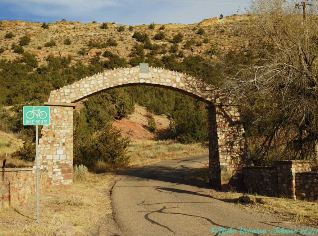
In 1932 a rock archway was built by local inmates. Warden Best would supervise this task and would ask each state governor to supply a rock to build the arch. Most the states didn’t hesitate, with state representatives of Kentucky even sending parts of Stalactites from Mammoth Cave. One state didn’t send a rock right away though… New York Governor Franklin Delanor Roosevelt would first write back and ask if it was for public or private usage. Upon hearing it was indeed for the public, he agreed to send a stone.
White Marble stone from a quarry in Fremont County marks each state near the rock(s) they sent.
Skyline’s popularity soared and soon a Snack Shack was built on top the road in 1956. The Skyline Pavilion was a Swiss Chalet style hut run by Joe Chapman that had three binoculars, snacks, and souvenirs. Sadly, a fire took all that in 1965.
Nothing was ever rebuilt on top of skyline, but the road and ridges still had a few surprises in store.
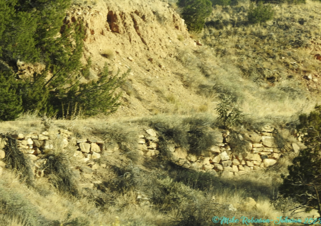
No official reports have been found, but local stories say that in the 1970’s there was a high-speed chase across the top, and a police car fell into the old Jewitts Brick Co. Clay Mine that was up on the ridge. The car was not recovered and that became known as “Cop Car Cave’.
In 1989 while exploring ‘Cop Car Cave’ a tourist fell to an untimely passing. After his recovery, 15 truckloads of cement were hauled up and all the mine opening sealed.
In the 1980’s there was also an idea to build “Razor Ridge”, a proposal to build a space needle and tourist stop at the top of Skyline, changing the name and charging admission. This idea was quickly dropped as opposition from locals was swift and loud.
In 1999, Bill Kurtz was a local paleontology student that noticed an odd rock formation. What he had noticed, he identified as a single dinosaur track. In 2000 volunteers from the Garden Park Paleontology Society worked diligently, and carefully exposing an entire section of tracks. These tracks would be identified as 107 million year old Ankylosaurs tracks.
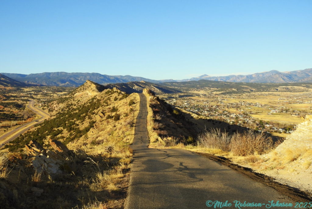
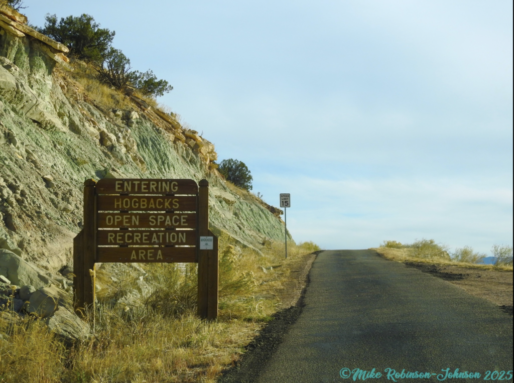
Today there is no snack shack, or space needle, but the dino prints remain. Skyline Drive is still an adored space by many of Canon City’s locals. It’s part of the Hogback Open Space, which is hiking, and biking trails along the bottom part on Canon side and across the top. The road is a one-way route with a speed limit of 15 MPH, but watch for walkers/runners, bikers and share the road. The entrance is off Highway 50 outside Canon City, and it exits on 5th Street in Canon City.
Remember its over 800feet above Canon and shouldn’t be taken lightly if you’re faint of heart or can’t do high roads with sudden drops on BOTH sides.
In 1948, a couple of tourists from Oklahoma decided to take the drive and after arriving at the top were afraid to travel back down. According to an Aug. 18, 1948, Daily Record article, “the group sent another tourist party for help but before the officer arrived, the group found someone to drive them down the mountain ‘as they huddled in the back seat of their car with a raincoat pulled over their heads.’”
Still, it’s a view everyone should see at least once, so who cares if you have to ask for help or call the police.
So….
What are YOU waiting for?
Colorado is Calling.
Get out and Explore.
More Photos by Mike Robinson-Johnson
This sign is as you start up the steepest climb on the one-way road
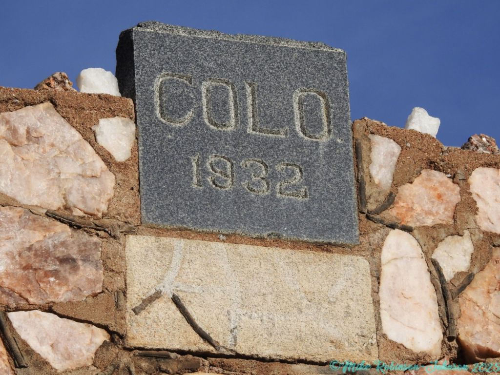
This marks the date the arch was erected above the entrance gate.
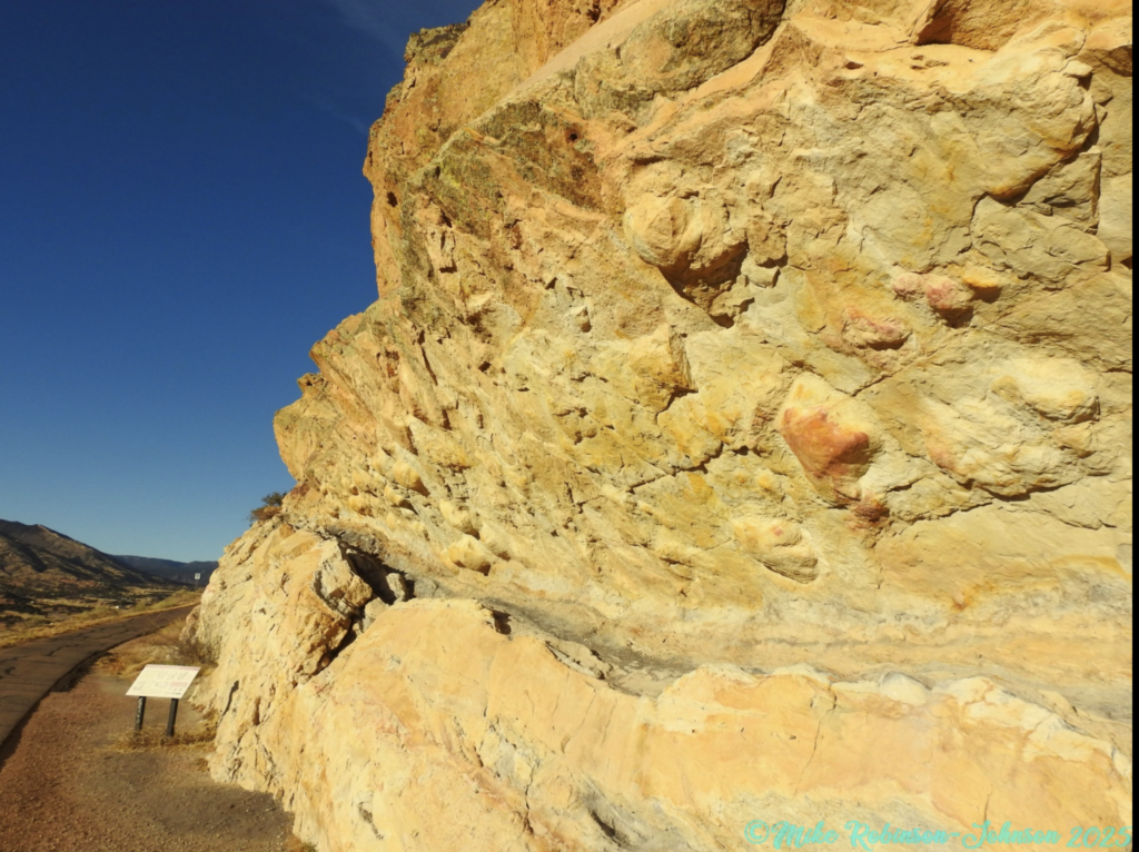
These tracks were made from dinos walking through wet ground leaving impressions. These low areas would quickly fill with sand, mud and other debris preserving a cast (think plaster of paris being poured into a shoe print). As the casts were covered over the course of millions of years, the ground would shift, breaking apart. These broken sections would lift creating the hogbacks that Skyline runs across, and the mountains in general. As they lifted the BOTTOM of the ground would be shown (Think of lifting the toes of your shoes while the heel stays planted).
Now, the exposed bottom of the cast is visible, just like the treads on your lifted shoe, and that’s how these dino tracks were made and can be seen today.
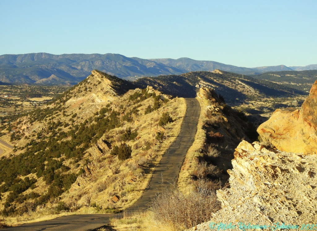
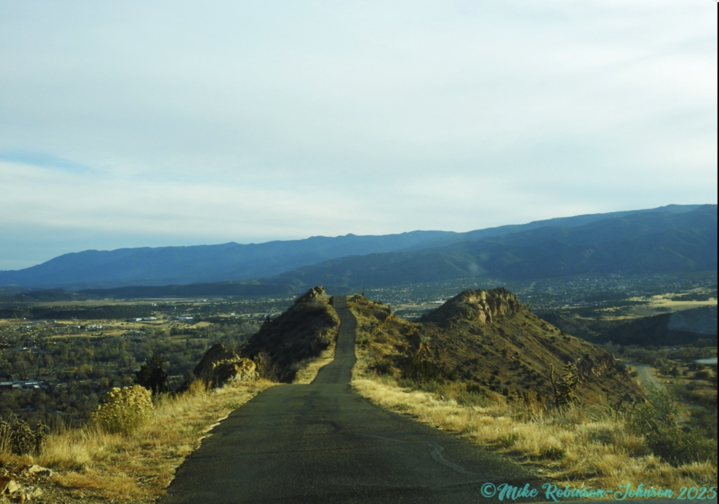
Makes me glad they made it a one-way road in 1924.
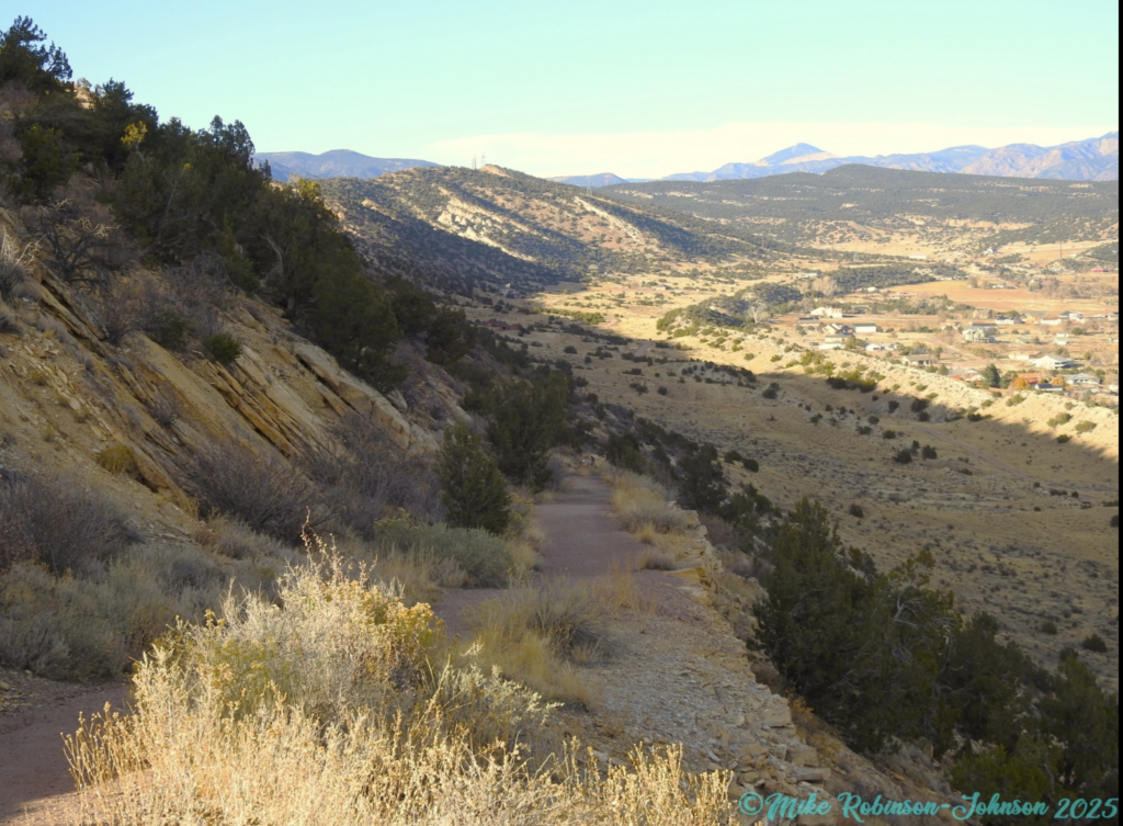
This section was closed to all traffic, and now is part of a walking trail in the Hogback Open Space area.